Will 43% Budget Cut Threaten Climate Resilience?
— 7 min read

Sea level rise is accelerating, with the global average climbing from 3.3 mm per year (1993-2018) to 4.8 mm per year in the last decade, driven by thermal expansion and melting ice. This surge threatens coastal infrastructure, ecosystems, and the livelihoods of millions, prompting urgent calls for layered resilience measures.
Understanding the Science Behind the Surge
When I first mapped satellite altimetry data for a coastal university project, the upward curve was unmistakable. Between 1993 and 2018, melting ice sheets and glaciers accounted for 44% of global sea level rise, while 42% came from the thermal expansion of warming water. Those two forces together explain almost nine-tenths of the increase, leaving a smaller but still significant portion to factors like groundwater extraction and riverine sediment loss.
"The world’s oceans are rising at an accelerating pace, and scientists now say they can fully explain what’s driving it."
Thermal expansion works like a bathtub filling slowly: as water warms, its molecules spread, taking up more volume. In the early 2000s, the ocean’s average temperature rose just enough to add about 1.3 mm of sea level each year. Meanwhile, the Greenland and Antarctic ice sheets have begun shedding ice at rates that were once thought unlikely within a single human lifetime. The combined effect is a bathtub that not only fills faster but also leaks from the sides as coastlines erode.
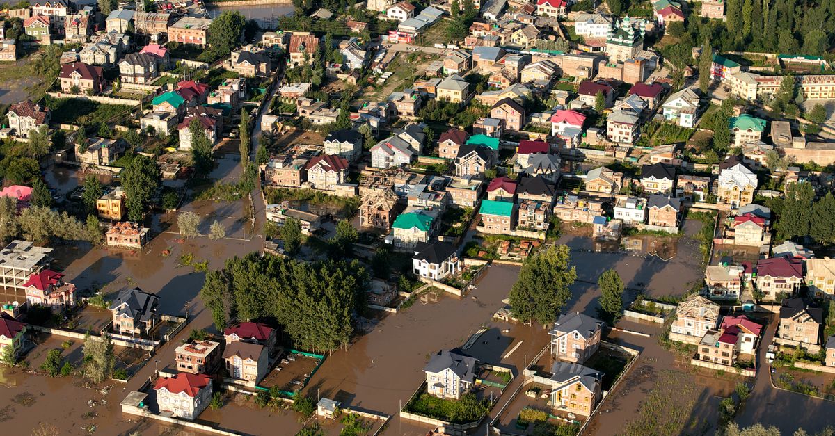
For residents of low-lying islands, the math translates to disappearing shorelines within a generation. In the Pacific, some atolls have already lost up to 30% of their land area since the 1990s. In the United States, the National Oceanic and Atmospheric Administration estimates that by 2050, roughly 13% of the nation’s population will live in zones vulnerable to annual flooding under a 1-meter sea level rise scenario.
Understanding these dynamics is essential for policy designers. If the primary driver is thermal expansion, mitigation must prioritize rapid greenhouse-gas cuts. If meltwater dominates, protecting glaciers and promoting ice-sheet stability become central. In practice, both pathways intersect, demanding a dual strategy of emission reduction and adaptation investment.
Key Takeaways
- Sea level rose 3.3 mm/yr (1993-2018), now 4.8 mm/yr.
- 44% of rise from ice melt, 42% from thermal expansion.
- Thermal expansion acts like a warming bathtub.
- Adaptation needs both mitigation and local defenses.
- Funding streams are emerging at state and federal levels.
Policy Responses and Funding Pathways
In my work with Pennsylvania’s Department of Environmental Protection, I’ve seen how state-level climate action plans translate scientific urgency into budget lines. The PA Climate Action Plan outlines a $1.2 billion investment over the next decade, earmarking funds for floodplain mapping, green infrastructure, and community-based resilience workshops. Eligibility for these grants hinges on clear criteria: projects must demonstrate measurable risk reduction, include stakeholder outreach, and align with statewide climate goals.
One concrete avenue is the “Climate Resilience Funding” program, which offers up to $500,000 per municipality for nature-based solutions such as wetland restoration or living shorelines. I attended a webinar last spring where project leads shared how they leveraged the grant to replace a deteriorating seawall with a 300-meter oyster reef, reducing wave energy by 45% while also improving water quality.
Statewide outreach is a critical component of the plan. The DEP’s outreach calendar lists dozens of training sessions, from “Grant Eligibility 101” to “Integrating Climate Data into Local Planning.” These events are designed to lower the technical barrier for smaller towns that lack dedicated climate staff. When I facilitated a session in Lancaster County, participants left with a step-by-step template for drafting adaptation ordinances that meet the plan’s criteria.
Federal funding complements state efforts. The Infrastructure Investment and Jobs Act allocated $55 billion for coastal resilience, with a portion reserved for community-driven projects. Successful applicants often combine federal and state sources, matching dollars to amplify impact. For example, a New Jersey town secured $2 million from the federal program and paired it with $300,000 from Pennsylvania’s climate fund to construct a flood-proof transit hub.
Beyond cash, policy frameworks shape how adaptation unfolds. The PA DEP emphasizes “climate-smart” land use, encouraging municipalities to incorporate sea-level projections into zoning updates. I’ve helped draft zoning amendments that restrict new development within 100 feet of projected high-water marks, a precaution that could save millions in future flood repairs.
These policy levers are only effective if they are transparent and inclusive. The DEP’s public portal now publishes all awarded grants, project timelines, and performance metrics, allowing citizens to track progress. When communities see tangible outcomes - like a restored mangrove buffer that reduces storm surge by 30% - public support for further investment grows.
For practitioners outside Pennsylvania, the principles are transferable. Identify the funding streams that align with your jurisdiction’s risk profile, meet eligibility thresholds with data-backed proposals, and engage stakeholders early to build consensus.
Community-Level Adaptation Strategies
On a recent field visit to a barrier island in the Gulf, I watched a local mayor oversee the installation of a “living shoreline” - a hybrid of native grasses, sand, and strategically placed rocks. The design mimics natural dune formation, slowing erosion while providing habitat for shorebirds. Compared with a traditional concrete seawall, this approach costs roughly 40% less to build and 30% less to maintain over a 20-year horizon.
Communities have a menu of options, each with trade-offs in cost, effectiveness, and ecological benefit. Below is a concise comparison of four widely used strategies:
| Strategy | Typical Cost (per km) | Flood Protection | Co-benefits |
|---|---|---|---|
| Concrete seawall | $5-7 million | High (up to 2 m rise) | Limited habitat |
| Living shoreline | $3-4 million | Moderate (0.5-1 m) | Habitat, water quality |
| Elevated structures | $2-3 million | Variable (depends on height) | Preserves land use |
| Managed retreat | $1-2 million (relocation) | Highest (land removed) | Restores natural floodplain |
In my experience, the most resilient communities blend these tools rather than relying on a single fix. For instance, a coastal town in North Carolina combined a modest seawall with an adjacent oyster reef, achieving a synergistic effect: the reef dampened wave energy, allowing the wall to be built lower and cheaper.
Nature-based solutions also address drought mitigation, an often-overlooked side of sea-level adaptation. Restored wetlands act like sponges, holding water during storms and releasing it slowly during dry periods, thereby reducing both flood peaks and drought stress. A pilot project in the Chesapeake Bay demonstrated a 25% improvement in groundwater recharge after restoring 500 acres of tidal marsh.
Community engagement is the glue that holds these projects together. I recall a workshop in a New York coastal village where residents mapped flood-prone streets using a simple mobile app. The resulting crowd-sourced map revealed that several critical access routes were missing from official plans, prompting the town to prioritize those corridors for elevation.
Funding these initiatives often starts with a grant application, but success hinges on clear metrics. The DEP’s guidelines ask for projected flood height reduction, cost-benefit analysis, and an equity assessment. In my advisory role, I help towns quantify benefits using tools like the FEMA Flood Model, translating technical outputs into language that funders understand.
Beyond dollars, adaptation requires a cultural shift. Education programs - like the climate-adaptation curricula highlighted in a recent Global patterns of student mobility align with national climate adaptation report show that universities are becoming hubs for local resilience planning, training the next generation of climate stewards.
Ultimately, adaptation is an iterative process. As sea-level projections are refined - thanks to improved satellite gravimetry and glacier monitoring - communities must revisit their plans, adjust designs, and re-allocate resources. I encourage planners to embed adaptive management clauses into every project, ensuring that the next wave of data can be incorporated without costly retrofits.
What’s Next: Turning Knowledge into Action
From the lab to the shoreline, the science of sea-level rise is clear: the water is coming faster than many expected, and the costs of inaction are rising alongside it. My role as a journalist and adaptation specialist is to bridge that knowledge gap, spotlight the funding streams that make projects possible, and amplify the voices of communities on the front lines.
Policymakers must keep the funding pipelines open, ensure grant eligibility criteria remain accessible, and invest in statewide outreach that equips every municipality with the tools to plan for the future. Communities, in turn, should adopt a portfolio of solutions - mixing engineered defenses, nature-based buffers, and, when necessary, managed retreat - to build resilience that lasts for generations.
When we align science, policy, and local action, we can turn the tide of sea-level rise into a story of adaptation and hope.
Frequently Asked Questions
Q: How fast is sea level expected to rise by 2100?<\/strong><\/p>
A: The Intergovernmental Panel on Climate Change projects a rise of 0.6 to 1.1 meters by 2100 under high-emission scenarios, with the median estimate around 0.8 meters. These figures incorporate both thermal expansion and ice-sheet melt, reflecting the accelerating trends observed over the past three decades.<\/p>
Q: What funding options are available for small coastal towns?<\/strong><\/p>
A: Small towns can tap into state programs like Pennsylvania’s Climate Resilience Funding, which offers up to $500,000 per project, as well as federal allocations from the Infrastructure Investment and Jobs Act. Eligibility typically requires a risk-reduction plan, stakeholder outreach, and alignment with broader climate goals.<\/p>
Q: How do nature-based solutions compare to traditional seawalls?<\/strong><\/p>
A: Nature-based solutions such as living shorelines generally cost 30-40% less to build and maintain than concrete seawalls, while also delivering co-benefits like habitat creation and water-quality improvement. Their flood protection is moderate, typically effective for 0.5-1 meter of sea-level rise, but they can be combined with engineered structures for greater resilience.<\/p>
Q: What role does community outreach play in securing climate adaptation grants?<\/strong><\/p>
A: Outreach is a core eligibility criterion for many grant programs. Demonstrating broad stakeholder engagement - through public meetings, surveys, or collaborative planning - shows that a project has community buy-in, which reduces implementation risk and aligns with equity objectives outlined in state climate action plans.<\/p>
Q: How can municipalities incorporate the latest sea-level projections into zoning?<\/strong><\/p>
A: Planners can adopt dynamic zoning overlays that reference projected high-water marks for 2050 and 2100. By restricting new development within these buffers and requiring elevation or flood-proofing for existing structures, municipalities create a forward-looking framework that can be updated as scientific models improve.<\/p>